Guest Blog By Michael Blehert, Big Marine Lake
It’s your choice. You can break your back and/or your wallet to have rip rock, sea walls and other barriers installed on your eroding shoreline or choose an alternative.
I chose the latter.
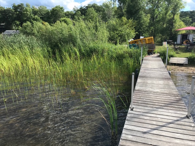
I own 100 feet of lakeshore on Big Marine Lake in NE Washington County. Our family uses and has cleared about 30 of the 100 feet for our beach. The remaining 70 feet is wild and natural, all cat tails, bull rushes and other native plants. The 30 foot wide area of land leading in a gradual slope toward the lake was covered with grass, clover, dandelions and other types of plants and was mowed several times per summer. It was not watered, fertilized or tended to in any manner and has been like this since about 1982.
In 2017, the water level was high when the ice froze. Expansion of the ice that winter pushed the leading edge of the slope back about eight inches, caused an ice heave and left a drop-off exposed to waves and high water in the early spring.
The Fix:
I decided to purchase silt socks to try and stop the erosion and stabilize the shoreline.
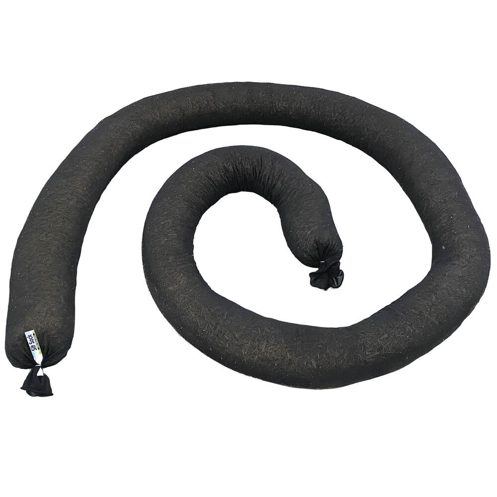
I staked one 20 foot long silt sock in place against the face of the ice heave in the portion of the shoreline that had the least plant coverage and was taking the brunt of the waves. That original sock is still in place, but was punctured allowing some of the filling to float away. In the spring of 2018, I added another sock on top of the damaged one and in spring 2020, I added a third sock covering a portion of the first two and the remaining portion of the shoreline.
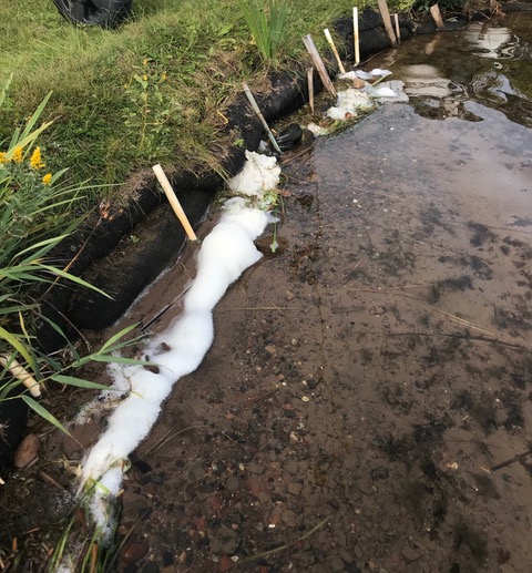
Note vegetation falling over the top and a close look shows water plant fragments and sticks washed over the top sock by waves. From May through July, the water level was about four/five inches higher than it was in September. The outlet weir for Big Marine Lake sets a high water level at about two inches above the bottom of the socks, but after a heavy rain(s), the water level can be three to five inches over the high water level for several weeks or more.
I’ll be encouraging the growth of more deep rooted native plants such as the wild Iris plant near the top of the socks.
Fast forward to August 13th, 2023. The record snowfall this last winter raised the water level in the spring up about six inches higher than in 2020.
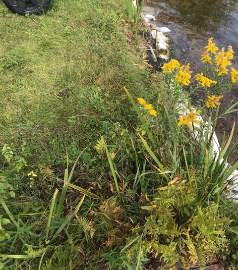
The level is now about one foot lower. All of the sock support stakes have been removed. There is a ramp to walk on or to launch kayaks, and other small boats. I pull out the ramp after the weekend so that the vegetation under it does not die. The Wild Iris has grown much larger than and is embedded into both the top and bottom sock. The native plants are deeply rooted into and through the socks.
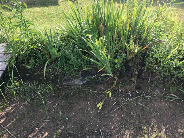
The row of vegetation to the right of the dock is now about two to three feet wide and I’ll let it spread backwards another few feet next year. Also, remember that in summer 2022 this area and most of Minnesota recorded a record high rainfall. At times, the water level reached about four inches from the top of the socks and the waves sometimes splashed up and over the top. There was no erosion or movement of the socks.
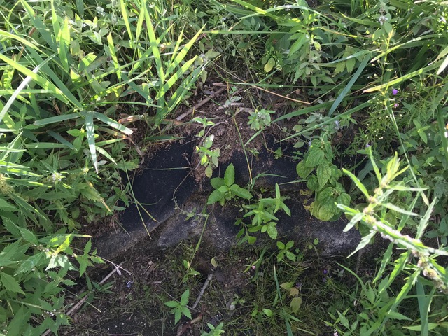
On left side of my dock there is also a sock, but it is completely covered with rooted plants. I let this area go completely wild since 2017. It’s covered with Joe Pye Weed, Swamp Milkweed, Blue Vervain, Ragweed, Wild Iris, several other plants and Cattails, Bull Rushes and Pickerel weed are in the shallows. I transplanted a few plants to the right side and others self seeded.